NIWA DataHub
Seabed sediment spatial data
Seabed sediment spatial data
Couldn't load pickup availability
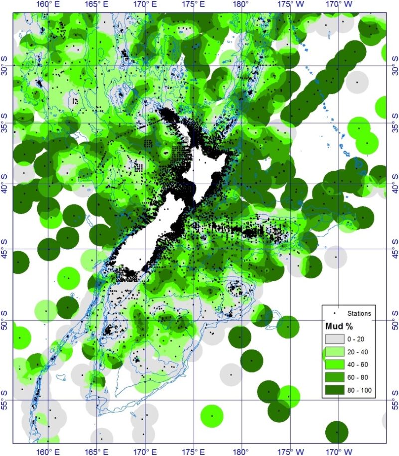
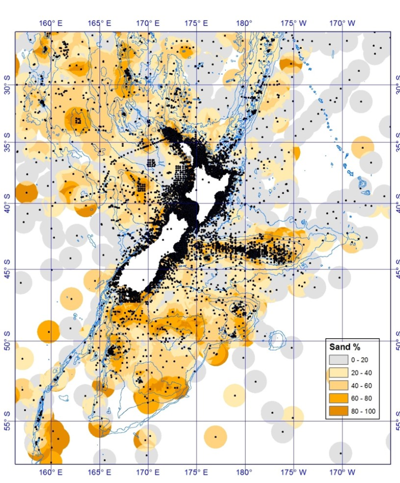
Data from ~150 published, unpublished, national and international collections covering >30,000 sediment analyses and observations were compiled and integrated to produce a database (nzSEABED) and series of maps characterising the surficial sediments of the entire New Zealand marine Exclusive Economic Zone (EEZ) and extended continental shelf (ECS). The dbSEABED software (http://instaar.colorado.edu/~jenkinsc/dbseabed/) was used to integrate the diverse, heterogeneous collated data. All the data are quality controlled. Processed and integrated sediment data from nzSEABED were interpolated using ordinary kriging based on the 12 nearest points with a restricted distance of 100 km, and plotted the data on a 1x1 km grid. The predicted standard error (standard deviation for any point) for percent mud for the kriging interpolation is low in well sampled regions such as the continental shelf and Chatham Rise (8-16%), and increases in the more sparsely sampled deep waters (20-24% at >3000 m). It should be noted that we have not included rocks in this database, thus the interpolated sediments will superimpose over rock outcrops.
The data is made available here for download at no charge for non commercial use only.
References
Bostock et al., 2018. Distribution of surficial sediments in the ocean around New Zealand/Aotearoa. Part A: continental slope and deep ocean. New Zealand Journal of Geology and Geophysics.
Bostock et al., 2018. Distribution of surficial sediments in the ocean around New Zealand/Aotearoa. Part B: continental shelf. New Zealand Journal of Geology and Geophysics.
Share